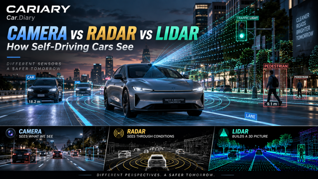
Self-Driving Car Sensors sound like a contest between three pieces of hardware: cameras, radar and LiDAR. But imagine a pedestrian standing at a crossing in the rain. The difficult question is not just whether the car detects a person. It is whether that person will step into the road, how certain the system is, and what it should do next.
That is what made us curious about the Tesla Vision debate. Could better cameras, better AI and a genuinely good cleaning system be enough? Or is there value in giving a machine senses that work differently from our eyes?
Let’s separate what each sensor measures from what the vehicle still has to understand. Throughout this article, automated driving includes different kinds of systems; a driver-assistance feature is not automatically a driverless car.
Quick Summary
- Camera: supplies detailed visual information that software can interpret as lanes, signs, signals and road users.
- Radar: measures range and motion using radio waves, including particularly useful toward-or-away speed information.
- LiDAR: measures surrounding geometry with laser light, producing a collection of 3D points.
- Cleaning: can restore a dirty optical cover, but cannot clear fog further down the road.
- Sensor fusion: combines complementary evidence, with extra integration work rather than a guaranteed safety improvement.
- The important distinction: sensing capability and driving responsibility are different questions.
Why This Matters: Seeing Is Only the Beginning
A driving system has several jobs. Sensing collects measurements. Perception turns those measurements into a description of the surroundings. Prediction considers how other road users might move. Planning chooses a response, and control turns that response into steering, acceleration and braking.
These are useful learning categories, not a claim that every company’s software contains five separate boxes. Some systems combine functions inside learned models. The underlying problems remain: what is there, what could happen, and how should the car respond?
A system might correctly recognize a cyclist yet make a poor decision about passing them. Equally, excellent planning cannot reliably compensate for a hazard that the sensing system has failed to detect. Hardware and software have to work together.
Self-Driving Car Sensors: Three Different Kinds of Evidence
The simplest comparison is not good, better and best. It is meaning, motion and geometry.
| Sensor | What it measures | What software can learn from it | Important limitation |
|---|---|---|---|
| Camera | Light forming an image | Object identity, signals, lane markings and visual context | Poor visibility can remove useful image information |
| Radar | Reflections of transmitted radio waves | Range, direction and relative motion | Separating nearby objects and interpreting their identity depend strongly on hardware and processing |
| LiDAR | Reflections of laser light | Distances and 3D surface structure | Weather, surface properties and coverage affect the returned points |
This is a starting point, not a set of exclusive abilities. Cameras can support depth estimation. Radar can produce spatial maps. LiDAR data can support object classification. The distinction is how the evidence is obtained.
Camera: Understanding What the Scene Means
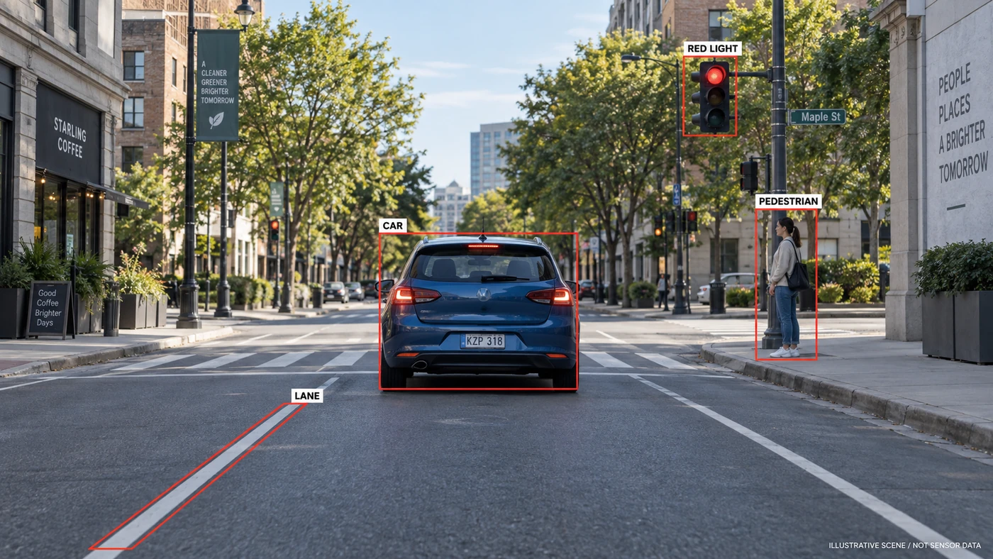
Look at a normal street photograph. You can distinguish a green signal from a red one, a bicycle from a motorbike, and a painted lane from a pavement edge. That richness makes cameras valuable: much of the road system communicates through visual details.
Engineers call the interpretation of those details semantics, which simply means identifying what things are and what they signify. The camera itself does not understand a traffic light. It records light; the software interprets the resulting image.
A neural network is a trained computational model that learns patterns from examples. In driving, such models can connect image patterns with objects, road boundaries and other useful features. That does not make every interpretation correct, particularly when an unfamiliar situation resembles something else.
Can a Camera Measure Distance Without LiDAR?
It can support distance estimates through multiple viewpoints, changes across video frames and learned visual cues. Think about how a nearby object moves across your view more quickly than a distant building as you travel past.
Tesla describes camera-based object detection, single-camera depth estimation and the combination of multiple camera views in its AI engineering overview. This is more sophisticated than treating each frame as an isolated photograph. However, an estimated depth still carries uncertainty, and poor input can make that uncertainty larger.
Night driving is not an automatic camera failure: exposure, sensor sensitivity, headlights and processing all matter. Strong glare, deep shadows and low contrast can nevertheless be difficult. A clean lens is necessary for a good view, not proof that every relevant detail is visible.
Radar: How Far Away, and How Fast Is the Gap Changing?
Radar sends radio waves and analyzes their reflections. It is especially valuable when the system needs to know how quickly the distance to another object is changing.
In a fictional example, an object is 42 meters ahead and the gap is closing at 15 km/h. Those are not the other vehicle’s road speed and stopping distance. They describe its position and movement relative to the measuring vehicle.
The Doppler effect helps radar measure motion along the line between sensor and target. This is radial velocity: toward or away. An object moving sideways needs additional tracking and geometry to reconstruct its full motion. Research on radar velocity estimation makes that distinction explicit.
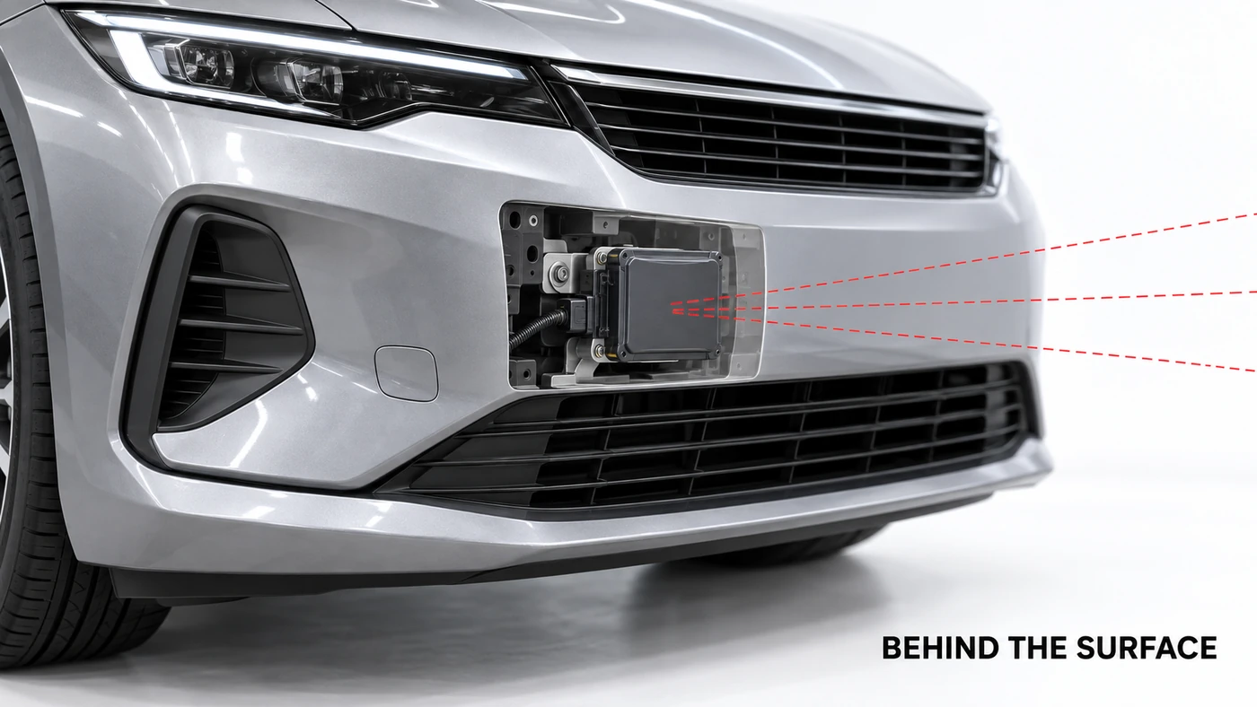
Radar is not merely a crude distance alarm. Modern imaging designs can separate objects in more detail than earlier units; Texas Instruments’ automotive radar resources include both long-range and imaging applications. But a rich radio reflection still does not read the red color of a traffic signal like a color image does.
More Weather-Tolerant Does Not Mean Weatherproof
Radio sensing often remains useful when visibility has deteriorated. That different response to the same environment is a major reason to combine it with cameras. Researchers have demonstrated radar observations in snowy and foggy conditions.
However, heavy precipitation can affect signals, and snow or contamination over the sensing area can obstruct operation. Reflections also need careful interpretation. As a concrete production-car example, Volvo’s radar troubleshooting guidance identifies heavy rain, snow and road spray as possible causes of blockage.
The useful statement is therefore more tolerant in many conditions, not unaffected by weather.
LiDAR: Building a World from Measured Points
LiDAR uses laser light to obtain distance information. A common design sends pulses and measures the time required for their reflections to return. The distance calculation accounts for the light traveling out and back. Other LiDAR architectures exist, so not every unit measures range in exactly the same way.
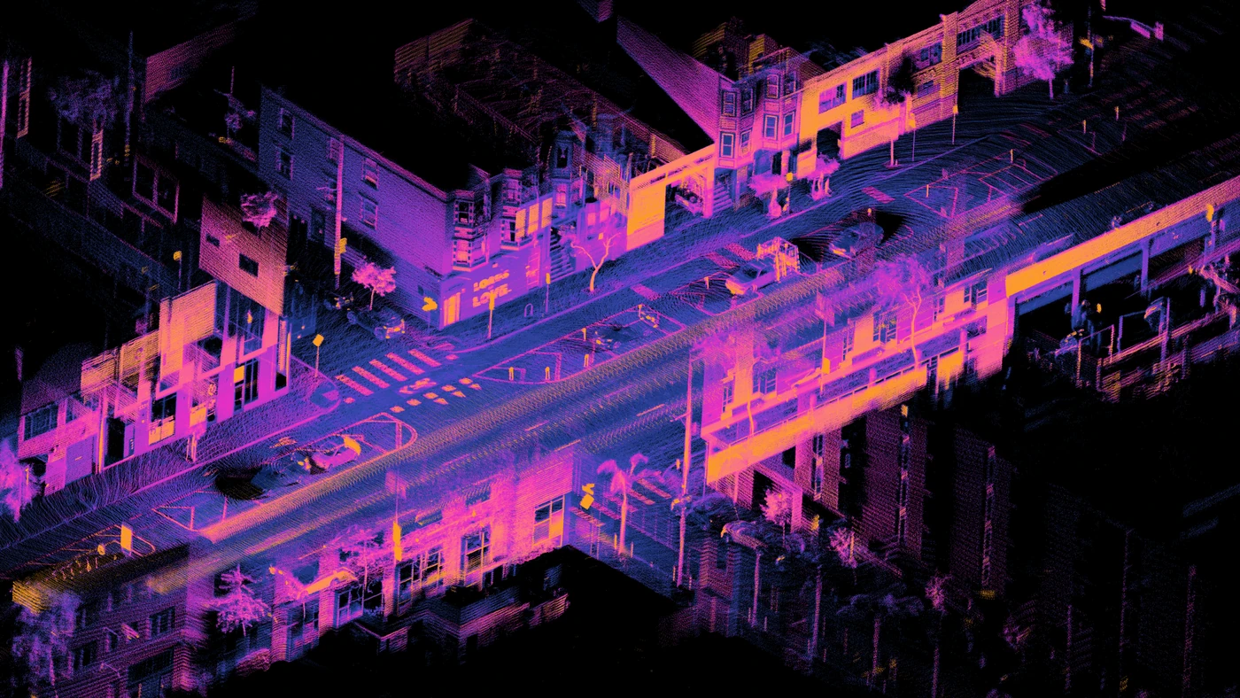
Repeat measurements in different directions and the results form a point cloud: many points positioned in three-dimensional space. Imagine marking the locations of surfaces rather than painting their colors. A vehicle, building or curb starts to emerge from those measurements.
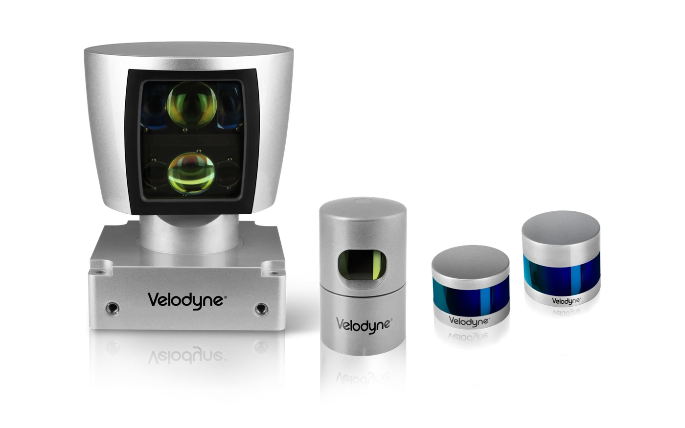
Because it supplies its own illumination, LiDAR does not need daylight in the way a conventional camera does. Its measurements can help distinguish free space from occupied space and provide geometric evidence alongside camera interpretation. Ouster’s explanation of its range and reflectivity data shows how different data layers can support detection.
Why a Point Cloud Is Not the Whole Answer
Points are still measurements to interpret, not complete understanding. A sparse return from a distant object may leave its outline unclear. A geometric surface does not necessarily explain whether someone intends to cross the road.
There are also packaging, processing, cleaning and cost trade-offs. The roof-mounted spinning unit familiar from early test vehicles is not the only design, and costs vary substantially; describing every LiDAR as huge or prohibitively expensive would be misleading.
Fog can scatter laser light and alter the returns. A study of time-of-flight LiDAR in fog explores that effect. Equally, it would be wrong to say all LiDAR becomes useless whenever it rains: Ouster’s rain demonstration is an example of useful operation, not a universal performance guarantee for other sensors or weather conditions.
Can a Washer Fix the Camera Problem?
This was the question we kept returning to. If rain or dirt makes a camera unreliable, why not give it a washer, heater and a better protective surface?
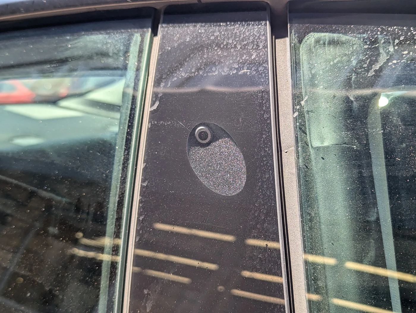
That is a serious engineering idea. A washer can remove some contamination. A heater can help with ice or condensation. Suitable coatings, air jets or wiping mechanisms can help keep an optical surface usable. Valeo develops sensor and camera cleaning systems for precisely this kind of need.
These measures need maintenance and appropriate integration: cleaning fluid can run out, coatings can wear, and not every deposit comes away easily. They also do not all perform the same task. Heating a cover does not necessarily remove an insect stuck to it.
Dirty Glasses and a Foggy Road Are Different Problems
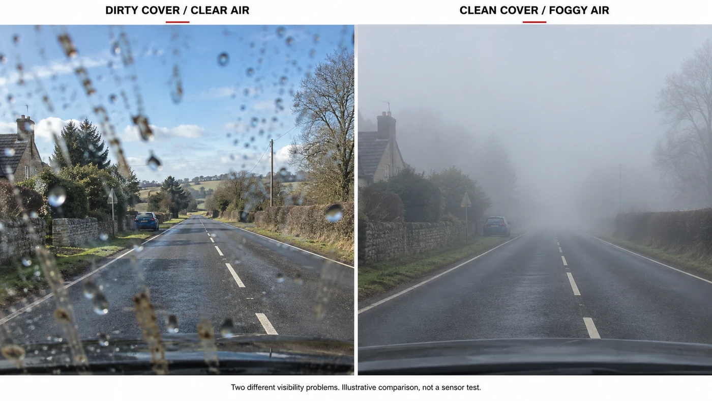
Cleaning dirty glasses helps you see. Cleaning already-clean glasses does not remove fog outside the window.
The same distinction applies to a car. Surface contamination is material on or near the optical cover. Atmospheric visibility loss occurs between the sensor and the object. Dense fog, heavy spray or blowing snow can reduce the useful light reaching a perfectly clean camera.
Overlapping cameras and tracking across previous frames can help maintain an observation through a brief interruption. But several cameras looking through the same fog may share the same limitation. Previous knowledge that a car was there is not a fresh measurement of everything that might now be there.
Our conclusion is not that cleaning is unimportant. It is that cleaning solves a valuable, specific part of the problem. Better AI can make more of the remaining evidence; it should not treat missing evidence as certainty.
Bad Weather: Compare Limitations, Not Star Ratings
| Situation | Camera | Radar | LiDAR |
|---|---|---|---|
| Darkness | Depends on available light, exposure and sensor capability | Does not rely on visible illumination | Supplies its own laser illumination |
| Dense fog | Contrast and visible distance can fall | Often retains useful measurements; not universally unaffected | Scattering can alter returns and usable range |
| Heavy rain or spray | Droplets and reduced visibility can obscure detail | Often more tolerant, but signal quality or availability can deteriorate | Returns can degrade; results vary with sensor and precipitation |
| Dirty or snow-covered sensing surface | Can obscure the image | Cover material and contamination can affect transmission | Can obstruct transmitted and returning light |
These are qualitative tendencies, not test scores. Weather intensity, target distance, mounting, hardware and processing all change the result. There is no responsible conversion from this table to a claim that one brand is safer than another.
Tesla Vision: Making Visual Information Work Harder
Tesla has strongly pursued camera-centric driving perception. The attraction is understandable: cameras capture many of the visual cues people use, while multiple views and video processing can support a surrounding model of the road.
The important combination is cameras, trained models, computing and real-world learning, not cameras alone. Tesla’s engineering material describes using fleet examples and evaluation tools to improve perception and planning. That explains its development approach; fleet size by itself does not prove that rare hazards are handled correctly.
A simpler sensor suite can reduce some hardware cost, packaging and cross-sensor calibration demands. It does not make the software problem simple. Multiple cameras still require alignment, synchronization and reliable processing. Combining their views is also a kind of information fusion; here, the debate concerns adding different sensing technologies.
The familiar argument that people drive with eyes is a useful starting analogy, not a safety demonstration. People misjudge scenes too. A machine’s broad coverage and lack of biological fatigue are potential advantages, while its failure patterns differ from a human’s.
For consumer FSD (Supervised), Tesla explicitly requires active driver supervision and says the feature does not make the vehicle autonomous. Hardware and available features vary by vehicle and region. That statement concerns the consumer assistance product, not a blanket description of every Tesla development or robotaxi deployment. See Tesla’s current FSD support guidance.
Sensor Fusion: Different Measurements, One Road Model
Now consider the other approach. A camera suggests that an object is a car. Radar contributes range and closing motion. LiDAR contributes measured shape and position. Sensor fusion associates those observations with the same object and uses them together.
The measurements must line up in both space and time. Calibration establishes how sensors are positioned relative to each other; synchronization helps avoid combining yesterday’s position, figuratively speaking, with today’s image. Bosch’s sensor fusion overview describes the complementary use of camera and radar information.
There is an important distinction between adding detail and providing a backup. A second sensing technology offers useful redundancy only when its coverage and the rest of the system can support the relevant task during a fault. A sensor that faces elsewhere cannot necessarily replace the one that failed.
Nor are different technologies completely independent. A shared power problem, blocked mounting area or software defect can affect more than one input. Good design considers those shared failures, not just the number of sensor housings.
What Happens When the Sensors Disagree?
Perhaps the camera detects a vehicle but radar has no convincing matching return. That does not automatically mean the camera is wrong. The object could be outside a useful radar angle, difficult to reflect from, or associated incorrectly.
The system needs to consider confidence, sensor health and previous observations. It may need a more cautious plan rather than a simple majority vote. This is an engineering explanation of the problem, not a claim about any one manufacturer’s hidden decision rules.
More sensors therefore add both opportunity and work. They generate additional evidence; the system still has to use it appropriately.
From Detection to Prediction: Will That Person Cross?
Finding a pedestrian is one task. Anticipating their movement is another. They might keep walking, stop to look at a phone, or step into the road.
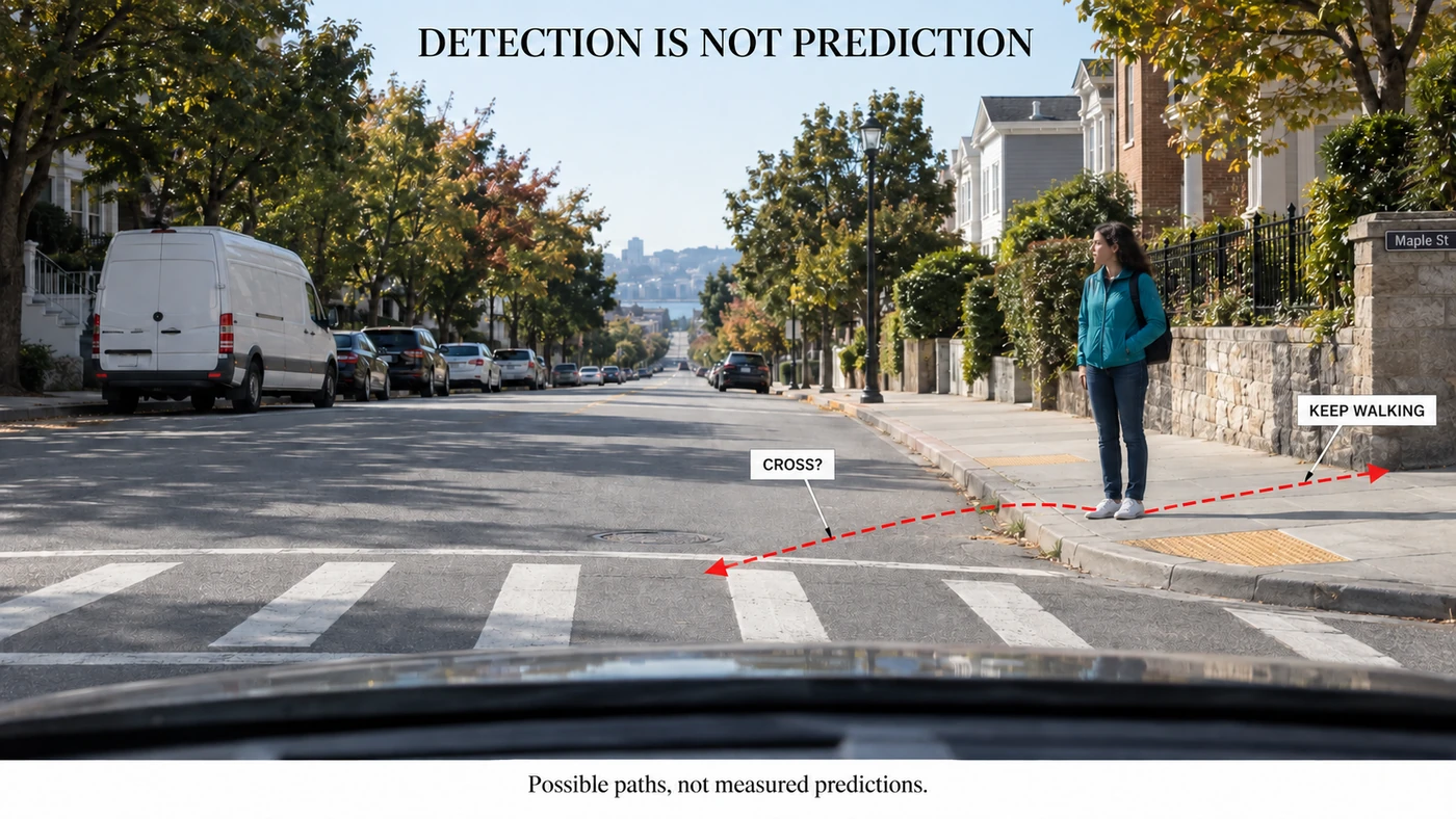
A prudent planner needs to consider more than one plausible future. Posture and movement can provide clues, but apparent eye contact is not a guarantee. The vehicle also has to account for what is hidden behind parked vehicles or buildings.
This is why a beautiful perception display is not sufficient evidence of capable driving. The important question is what the system does with uncertainty: how it chooses space and speed, responds to changes, and handles a situation outside its capabilities.
The Supporting Cast: Position, Motion and Maps
GNSS, which includes GPS, helps estimate geographic position. An IMU measures acceleration and rotation, helping track the vehicle’s own motion. NovAtel explains how GNSS and inertial measurements complement each other, including during short interruptions to satellite reception.
Maps can provide road context, but they cannot guarantee that a lane is unobstructed today. Ultrasonic sensors, where fitted, use sound for nearby obstacle measurements, commonly around parking distances. These tools supplement perception; none replaces checking the live scene.
The final response still depends on ordinary vehicle fundamentals: tires, brakes and steering must carry out the plan. Our Car Basics for Enthusiasts guide connects those physical systems to what the car can actually do.
Real-World Example: Why a Waymo Looks Different
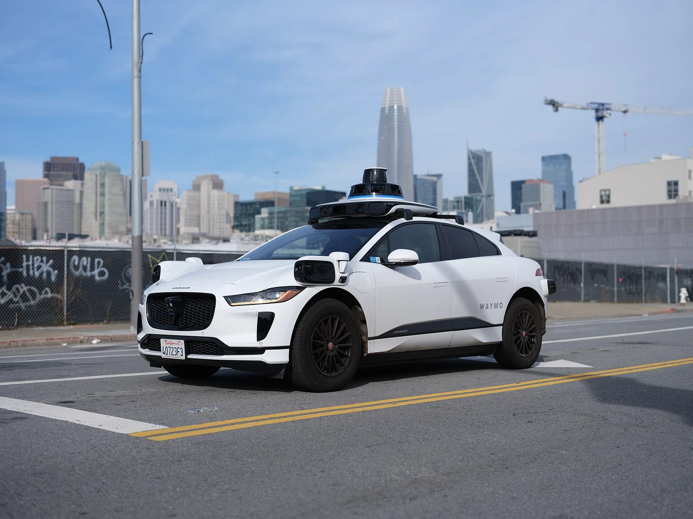
The sensor housings on a Waymo vehicle make the multi-sensor philosophy easy to see. Its February 2026 description of the sixth-generation Driver identifies cameras, imaging radar and LiDAR working together, including cleaning provisions for its cameras. The photograph above is an older Jaguar I-Pace installation, not that new generation. Waymo’s sixth-generation announcement provides the current technical context.
This is an example of an architecture, not proof that every multi-sensor vehicle matches Waymo’s capabilities. Equally, comparing a driverless service in defined operating conditions with a consumer assistance product used under driver supervision is not a controlled test of camera versus LiDAR.
Packaging also matters. Sensors need usable sightlines, suitable mounting and protection; they are part of a complete vehicle, not equipment floating outside it. Car Structure Basics explains the body and packaging foundations underneath that integration.
Automation Levels Are About Responsibility, Not Sensor Count
Two cars with similar hardware can place very different duties on the person inside. The familiar levels describe a driving feature’s task and fallback arrangement, not a quality score for its sensors.
| Level | Simplified meaning |
|---|---|
| 0 | The person drives; warnings or brief safety interventions may still exist |
| 1 | Assistance with steering or speed while the person drives |
| 2 | Assistance with both steering and speed; the person continuously supervises |
| 3 | The system performs the driving task within stated conditions; a fallback-ready user must respond appropriately when required |
| 4 | Within its operating conditions, the system handles the driving task and fallback without expecting a human driver to take over |
| 5 | Full driving automation across on-road conditions a human driver can manage, rather than a limited operating domain |
An operational design domain, or ODD, means the conditions a feature is designed to operate in, such as particular roads, speeds or weather. Higher levels do not mean immunity to physics. This overview follows the responsibility distinctions in NHTSA’s automation explainer.
Which Approach Is Safer? Ask Better Questions
There is no honest safety ranking based only on the list of self-driving car sensors. Cameras plus excellent engineering can outperform a poorly integrated collection of expensive hardware. Complementary measurements can also address limitations that better image processing alone cannot remove.
When reading a demonstration or claim, we would ask:
- What driving task is the feature actually designed to perform?
- Which roads and weather conditions are included?
- Who must supervise, and what happens when the system cannot continue?
- Does the evidence include difficult cases, not just successful demonstration clips?
- Are comparisons matched for exposure, operating conditions and human involvement?
Those questions do not dismiss progress. They make progress easier to understand. A sensor specification, a dramatic video and a validated end-to-end safety result are different kinds of evidence.
Common Misconceptions
A camera cannot estimate distance. It can, using suitable processing and visual information. That differs from obtaining an independent laser or radio range measurement.
LiDAR means the car is autonomous. A sensor says nothing by itself about who performs the driving task or handles failure.
Cleaning solves bad-weather perception. It helps with contamination, not every obstruction between the car and the scene.
A missing radar return proves there is no object. A measurement can be unavailable or ambiguous; absence of a return is not universal proof of empty space.
More cameras eliminate blind spots and uncertainty. Overlap can help, but coverage, obstruction and shared conditions still matter.
Cariary Thoughts
What interested us most was not the argument over whether Tesla should add another sensor. It was the less glamorous question: how do you keep the existing sensors useful?
A washer and heater do not sound as exciting as a neural network. Yet a brilliant model looking through a dirty cover starts at a disadvantage. The more we studied the subject, the more sensor cleaning looked like part of the perception system itself, not a convenience accessory.
At the same time, we had to separate that thought from a different one. A clean view through the cover is not necessarily a clear view down the road. That distinction leaves a meaningful role for measurements based on different physics.
We do not see this as a competition between intelligent software and extra hardware. Both approaches need strong software, reliable inputs and an honest understanding of their limits. The part we most want to see demonstrated is how well a system recognizes uncertainty and responds to it.
One-line Summary
Self-driving car sensors collect different kinds of evidence; capable automated driving depends on how the whole system interprets that evidence and handles what it still cannot know.
FAQ
What Are the Main Self-Driving Car Sensors?
Cameras, radar and LiDAR are the main technologies discussed here. Vehicle designs may use different combinations, with positioning and motion measurements supporting them. The combination alone does not establish an automation level.
Does Tesla FSD Mean I Can Stop Paying Attention?
No. Consumer FSD (Supervised) requires active driver supervision. Follow the instructions for your specific vehicle, software and region; the product name does not remove that responsibility.
Can Radar Replace Cameras?
Not as a like-for-like source of visual meaning. Radar can contribute valuable position and motion measurements, but traffic-light colors and written signs are different information.
Does LiDAR Work at Night and in Rain?
Its own illumination supports operation in darkness. Rain does not automatically disable it, but precipitation and fog can affect returns. Useful range and detection depend on the equipment and conditions.
Would Better Camera Cleaning Make Vision-First Driving More Convincing?
It can improve the availability of visual information and is worth taking seriously. It does not establish complete driving capability, and it cannot clear atmospheric fog or reveal a fully hidden object.
Is Sensor Fusion Always Better Than Camera-Centric Perception?
No universal answer follows from the architecture alone. Different measurements can provide cross-checks and useful redundancy, while calibration, synchronization and failure handling add complexity. Compare the complete feature and its demonstrated operating limits.
Related Thoughts
- Car Basics for Enthusiasts: The Complete Guide: the mechanical systems that must execute every automated driving decision.
- Car Structure Basics: 5 Essential Ideas to Enjoy Cars: understanding the physical vehicle that surrounds the sensors.
References
Technical and product information checked September 13, 2026. Manufacturer descriptions establish stated architecture and feature scope, not an independent comparative safety ranking. Photograph sources and licenses appear with each image; AI scenes are explicitly illustrative.
- Tesla: FSD (Supervised) feature scope and driver responsibility
- Tesla: AI, camera processing and evaluation
- Waymo: sixth-generation Driver, February 2026
- Bosch: sensor data fusion
- Texas Instruments: automotive radar
- Gao and colleagues: radar under adverse weather
- Shifrin and colleagues: radial and tangential velocity estimation
- Volvo: radar blockage examples
- Ouster: range data and object detection
- Ouster: a rain demonstration and its limitations
- Research: what happens to a time-of-flight LiDAR in fog
- Valeo: sensor and camera cleaning
- NovAtel: GNSS and inertial navigation
- NHTSA: automated vehicle safety and automation levels